Chances are you’ve heard of GPS before, but GNSS might sound a little unfamiliar. GNSS, short for Global Navigation Satellite Systems, refers to a collection of satellites that provide location data and other information to devices on the ground. This system is often confused with GPS, but the two have some distinct differences. Below, we’ll take a closer look at how GNSS compares to GPS and what to expect from these systems in the future.
Introduction to GNSS and GPS
GNSS stands for Global Navigation Satellite System, an umbrella term that includes all global satellite navigation systems. GNSS provides autonomous geo-spatial positioning with global coverage. This system allows a GNSS receiver to determine its location (latitude, longitude, and altitude) by processing satellite signals. GNSS encompasses a variety of orbiting satellites from different countries and systems, including:
- GPS (United States): The first operational GNSS system, becoming fully operational in 1995.
- GLONASS (Russia): A system developed by the Soviet Union, restored to full coverage in 2011.
- Galileo (European Union): Europe’s global navigation satellite system, which began offering services in 2016.
- BeiDou (China): China’s navigation system, which achieved global coverage in 2020.
As said above, GPS is actually a part of GNSS and was the first operational satellite navigation system. It specifically refers to the United States’ constellation of satellites providing PNT services. It was the first fully functional GNSS and still is the most widely used system globally. The GPS network consists of at least 24 satellites orbiting the Earth, providing precise location and time information to users worldwide. The United States government maintains the system, and anyone with a GPS receiver can access it.
How GNSS and GPS Work
These systems use a method called trilateration, which measures distances from at least three satellites to determine the receiver’s position. Each satellite transmits a signal containing orbital information and precise time stamps. The receiver then calculates how long it took for the signal to reach it. By combining the distance measurements from multiple satellites, the receiver can then determine its three-dimensional position on Earth.
Differences Between GNSS and GPS Technologies
While these two terms are often confused with each other, there are some distinct differences between GNSS and GPS technologies:
Number of Satellites
GNSS provides better coverage and accuracy by tapping into satellites from various systems such as GLONASS, Galileo, and BeiDou, in addition to GPS. This mix of satellite signals can significantly boost positioning accuracy, especially in challenging environments like urban canyons or mountainous regions where satellite signals can be obstructed.
GPS, on the other hand, depends solely on its own set of satellites. While it offers broad coverage and high precision in open areas on clear days, it can struggle in environments where satellite signals are blocked, such as dense urban areas or thick forests.
Applications and Services
With its wider reach, GNSS opens up various applications beyond what GPS alone offers. This includes enhanced precision in aviation, maritime navigation, disaster management, and military operations. By using signals from multiple satellite systems, GNSS provides greater reliability and accuracy, which is crucial for these critical applications.
GPS is primarily used in the United States for car navigation, mobile positioning, and outdoor activities like hiking and geocaching. While GPS has numerous applications, GNSS extends these capabilities with its global coverage, supporting more complex and demanding use cases worldwide.
Signal Frequency and Accuracy
GNSS satellites transmit signals on multiple frequencies, which allows for more precise positioning using advanced methods like multi-frequency carrier phase measurements. These various signals also improve the system’s ability to handle signal interference and multipath effects, leading to higher accuracy and reliability.
GPS primarily uses the L1 frequency to transmit signals, which affects its accuracy and makes it more susceptible to interference. However, the introduction of the new L5 frequency in GPS has begun to address these issues, enhancing accuracy and reducing interference.
Future Prospects
GNSS and GPS have revolutionized global navigation and positioning. With ongoing advancements in satellite technology and the integration of signals from various systems, the future looks promising for these technologies. Enhanced accuracy, reliability, and coverage will continue to improve, supporting an ever-growing range of applications in both civilian and military domains. As these systems evolve, they will play an increasingly vital role in our daily lives, from personal navigation to critical infrastructure management.
The Role of GNSS in ADAS
Modern cars use GNSS (Global Navigation Satellite System) tech more to boost navigation accuracy and back up advanced driver-assistance systems (ADAS).
Navigation and Real-Time Traffic Information
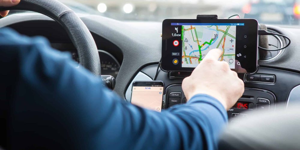
At the most basic level, GNSS enables in-car navigation systems to provide drivers with real-time directions and traffic information. By pinpointing the vehicle’s location with high precision, GNSS and GPS help to suggest the fastest routes, avoid congested areas, and reduce travel times.
These systems can dynamically update routes based on current traffic conditions, road closures, and other factors that might impact travel. Additionally, GNSS and GPS technologies assist in finding points of interest such as gas stations, restaurants, and hotels, enhancing the overall driving experience. By improving navigation accuracy and efficiency, these technologies contribute to safer and more convenient journeys for drivers and passengers alike.
Vehicle-to-Vehicle (V2V) and Vehicle-to-Everything (V2X) Communication
GNSS is critical for V2V and V2X communications, technologies that allow vehicles to communicate with each other and with road infrastructure. By sharing precise location data, cars can warn each other about potential hazards, such as sudden braking, accidents ahead, or unsafe traffic conditions. This connectivity can prevent collisions and improve traffic flow, making roads safer.
Precision Mapping and Lane-Level Navigation
For autonomous and semi-autonomous vehicles, GNSS is needed for precision mapping and lane-level navigation. High-definition maps, essential for autonomous driving, rely on GNSS data and other sensor inputs to accurately position the vehicle within centimeters. Autonomous cars need this precision, especially in complex driving situations like intersections, roundabouts, and highway exits.
By integrating GNSS and GPS data with other vehicle systems and sensors, modern cars are becoming safer, more efficient, and more capable of handling today’s roads. As more autonomous vehicles hit the road, these systems will play an even larger role in creating a safe driving experience.
GNSS vs GPS – The Future of Navigation
The evolution of GNSS technologies and their integration with Advanced Driver-Assistance Systems (ADAS) promises to revolutionize the automotive industry.
- Sensor Fusion: The fusion of GNSS data with inputs from a wide array of sensors (like LIDAR, radar, cameras, and ultrasonic sensors) will become more sophisticated. This integration will improve positioning, even when GNSS signals are weak.
- Artificial Intelligence and Machine Learning: AI and machine learning algorithms will eventually process and analyze the data generated by GNSS and sensors. This will allow vehicles to make smarter, real-time decisions.
- Multi-Constellation GNSS Receivers: Future vehicles will increasingly utilize multi-constellation GNSS receivers that can access signals from multiple satellite systems. This will improve positioning accuracy and reliability, especially in challenging environments like urban canyons or dense forests.
- 5G Integration: The rollout of 5G networks will significantly enhance the capabilities of V2X technologies. The low latency and high bandwidth of 5G will enable real-time data exchange, supporting more responsive ADAS features and paving the way for fully autonomous driving.
While these advancements will improve navigation, they also have some limitations. As vehicles become more reliant on GNSS and related technologies, the risk of malicious attacks or system failures increases.
Ultimately, as cars and GNSS evolve, so will how we use them. From improved safety to new features like self-parking, there is much to look forward to.
Learn More About Navigation Systems or Start Your Own ADAS Calibration Center Today
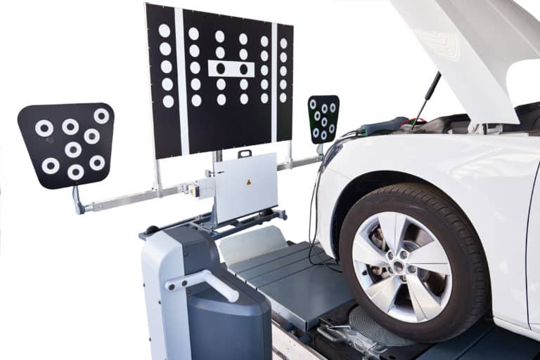
As we move towards a future where vehicles are increasingly connected and autonomous, the precision of GNSS and GPS is becoming more important than ever. With the rise of V2V and V2X communication, these navigation systems will be at the forefront of safe and efficient transportation. If you want to learn more about GNSS and GPS or are interested in starting your own ADAS calibration center, contact us today. Our ADAS calibration center solution offers both site certification and comprehensive training for your team.


